Helping Families One Home at a Time


CONTACT US

SEARCH

SITE MAP


Susan Marthens

Principal
Real Estate Broker
CRS  GRI

Phone
(503) 497-2984

ABOUT SUSAN

Working Together
Testimonials
Contact Susan

MOVING TO
PORTLAND

Find a Home to Buy
Rental Information
Find a Job
Moving Helps
Free Newsletter
BUYING A HOME
IN PORTLAND
First-Time Buyers
Home Styles
New Homes
Green Homes
Portland Home Prices
Home Inspections
Landslides
Real Estate Law
Property Taxes
Measures 37 & 49
CONDOS
List of Condos
Downtown Condos
River Front Condos
So. Waterfront Condos
Other Condo Projects
SEARCH FOR HOMES
Search by Metro Map
Search by Neighborhood
Featured Listings
Search by Listing No.
Quick Search
Search Guide
Login
MORTGAGES
Mortgages
Mortgage Rates
Calculators
SELLING A HOME
 IN PORTLAND
Selling a Home
How I Sell Your Home
Moving Helps
PLACES TO LIVE
 IN THE CITY
Neighborhood Guide
Close-in
> Goose Hollow
> Pearl
> Nob Hill/Northwest
> South Waterfront
West Hills
> Arlington Heights
> Forest Park
> Hillside/King's Heights
> SW Hills/Portland Heights
Southwest
> Bridlemile
> Hillsdale
> Multnomah
> So. Portland/Lair Hill
> Sylvan-Highlands
Southeast
> Eastmoreland
> Hosford-Abernethy
> Mt. Tabor
> Sellwood-Moreland
> Sunnyside/Hawthorne
Northeast
> Alameda
> Beaumont-Wilshire
> Concordia
> Grant Park
> Irvington
> Laurelhurst
North
> Boise
> Piedmont
> University Park
PLACES TO LIVE
 IN THE SUBURBS
Beaverton
Lake Oswego
Tualatin
West Linn
PORTLAND
The City
Geography
Weather
Praises for Portland
Buses & Trains
Commuting to Work
Planning for Growth
Outdoors
Portland & Pets
Portland Links
Portland Views
FOOD
Food & Drink
Farmers Markets
Dining Out
VISIT PORTLAND
Visitors Guide
Hotels & Eating
What To Do
House Hunting
Beyond Portland
SCHOOLS & KIDS
Public Schools
Private Schools
Preschool
Oregon Tests
National Tests
SAT Scores
Report Cards
No Child Left Behind
Evaluate Schools
Oregon Colleges
Tested Toys
OREGON
Oregon
Geography & Climate
Oregon Outdoors
Oregon Taxes
Oregon Golf
Oregon Links
OTHER
Search
Site Map
Feedback
Privacy Policy
Terms of Use Policy


Find a Home
in Portland

Looking for a home to buy?
Use our
Search for Homes Tool

Neighborhood Search
or
Metro Map Search


Guide to Portland's North Neighborhoods

Boise - Piedmont - University Park

This 31-foot-tall statue of Paul Bunyan greets visitors to North Portland.  It was created in 1959 to mark Oregon's centennial and was recognized as a "well-crafted example of roadside architecture" according to the National Register of Historical Places. The Paul Bunyan statue is Oregon's only roadside architecture in the register.  The statue was commissioned by the Kenton Businessman's Club to greet the millions of visitors to the Centennial Exposition, set up at the current-day Expo Center in North Portland at a time when Interstate Avenue was the main gateway to Portland.

Many people regard the neighborhoods of north Portland as the area of opportunity. If you review appreciation in the Portland metro area the last few years, you will find that North Portland has been at or near the top for the last few years. 

In 2002, the average price of a home in North Portland was $146,300 and by 2008 the average price has increased to $266,100. In 2001 North Portland had the highest home value appreciation in the Portland metro area as well as the lowest average price within the city.  The average home price for North Portland was $134,100 (average home price in the metro areas was $201,000) and the appreciation was 7.3 percent over the year 2000.

The Interstate MAX Yellow Line, a 5.8-mile segment, has sparked even more interest in the North.  The MAX Yellow Line connects the Expo Center in North Portland with downtown and the rest of the transit system. It opened in the Spring of 2004.

Sentinel for North Portland Community News Coverage

The Portland Sentinel does an excellent job of covering the news for the North Portland neighborhoods as well as those Northeast Portland neighborhoods along the boundary between the two areas such as Concordia, Eliot, King and Piedmont. 

North Portland Tool Library

The North Portland Tool Library (NPTL) is a community resource that loans a wide variety of tools to community members free of charge. The Tool Library benefits North Portland residents by reducing the costs of maintaining and improving their homes, building community, and sustaining diverse, livable neighborhoods. Registration with the Library is free to residents of North Portland.  The Library is located in the basement of the historic Kenton Firehouse at 2209 N. Schofield.

Portland Monthly Magazine Neighborhood Guide

The Portland Monthly magazine features neighborhoods in their April issue every year. It has a ton of information about neighborhoods and communities to include their pick of the "best" for the year.

To help those in the housing market, the magazine combines data from Portland neighborhoods and suburban communities online.  Include in the document are housing prices, school ratings, demographics, crime statistics, parks, commuting information, and services. Click here to view the report.

Walking in 
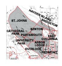
North Portland Neighborhoods

Walk Score ranks 2,508 neighborhoods in the largest 40 U.S. cities to help you find a walkable place to live.  The top 7 neighborhoods in Portland are Walkers' Paradises. 45% of Portland residents have a Walk Score of 70 or above. 83% have a Walk Score of at least 50—and 17% live in Car-Dependent neighborhoods.  We have created a Walk Score for each of the neighborhood profiles below. Please note that we use an address in the center of each neighborhood to determine the Walk Score.  Scores will vary in a neighborhood depending upon the address.  

Transit Score provides a 0-100 rating indicating how well an address is served by public transportation. Ratings range from "Rider's Paradises" to areas with limited or no nearby public transportation.

North Portland Dreams of its Own River Trail System

A group of North Portland advocates hopes that one day a riverfront trail will stretch between St. Johns, or points north, to the Vera Katz Eastbank Esplanade and the Steel Bridge. It's tempting for Greenway advocates to make the dreamlike comparisons because the Springwater Corridor has provided such a boost to the Sellwood area. The Greenway is indeed just a dream for now, though it does have a Web site, www.npgreenway.org, and a handful of reports and studies supporting its creation. Advocate estimate that it will take 10 years for the Greenway to receive funding and be fully constructed. It could provide a safe alternative for bicyclists seeking a route from the St. Johns, Portsmouth, Overlook, Bridgeton, Arbor Lodge and University Park neighborhoods and avoid existing bike lanes on treacherous roads.

Search for Homes in North Portland

To search for homes in North Portland, go to Search North Portland.  You can use over 100 search parameters and then select a specific area off a community map by drawing a box around that area. Alternatively, you can just specify the criteria and obtain all the current listings in North Portland.  You can also search by a specific neighborhood.

Boise

View all
Boise
Homes for Sale
From the
Multiple Listing Service

Boise Homes for Sale


Boise Boundaries

West - Interstate 5
East - N. Rodney Ave./ N. Mallory Ave./N. MLK
 North - N. Skidmore Street
South - N. Freemont Street/Underpass of I-405


Maps of
 Boise Neighborhood

Click to enlarge

Map Showing
Neighborhood Boundaries

Boise

Google Maps

Boise


Quote in the
Portland Tribune February 18, 2005 edition

It’s going to be an interesting and fun street for Portland,
racially diverse and full of artists and musicians,”
 said Philip Stanton, owner of the Mississippi Pizza Pub,
3552 N. Mississippi Avenue.


Basketball court

Denorval Unthank Park is a 4.5 park in the heart of the Boise neighborhood.  Facilities include a softball field, soccer field, basketball court,  and playground.


Walking Tour

This 2-mile loop starts at a bluff in Overlook Park, then to a pedestrian bridge over I-5 to the neighborhood restaurants, shops, and galleries along North Mississippi Avenue.

Click here to download the guide.


Boise Walk Score


In the mid-1980s, maybe 5-6 businesses were operating on the five-block North Mississippi Avenue commercial strip between Fremont and Skidmore streets in the Boise neighborhood of North Portland.

It was a grim place!  You name it, N. Mississippi had it: drugs, gangs, street crime, prostitution, abandoned houses — all the elements of urban decay.  Today, there are more than 40 businesses on the street.  Restaurants, coffee shops, a bike shop, a nursery, furniture makers, a home rebuilding center, and even a couple of recording studios. Take a virtual shopping trip on Mississippi Avenue by clicking here.

What happened? For one thing, in 1999 the city of Portland created the Mississippi Historic District Target Area to improve public safety, upgrade housing and attract businesses. The city brought an army of bureaucratic tools — including home improvement loans, technical assistance and help — in dealing with the new designation. And the results are now starting to play out.

Has the effort been a success? The city hasn’t succeeded entirely in making sure that gentrification doesn’t drive out existing residents. Yes, crime and drugs are down while optimism is up. But the area still deals with undercurrents of racial and class mistrust in one of Oregon’s poorest and most diverse neighborhoods. Changes are happening quickly. People walk to the shops by day; at night, live music can be found at the Mississippi Pizza Pub where crowds and the music spill out onto the sidewalk on warm evenings.

The new Interstate MAX line is three blocks away, and neighbors hope that the low rents will attract more young artists who will help continue the revival. More than 60 percent of the neighborhood today is under 35, census figures show.

History

North Mississippi Avenue was populated in the 1800s by ship workers of European descent.  It became home to blacks after the 1948 Vanport flood and was part of Portland’s thriving postwar black community. In the 50s and 60s, construction of Interstate 5 and Memorial Coliseum tore out businesses and long time neighbors were cut off from each other.

Origin of Name

Reuben Patrick Boise (June 9, 1819 – April 10, 1907) was an attorney, judge and politician in the Oregon Territory and the early years of the state of Oregon. A native of Massachusetts, he immigrated to Oregon in 1850, where he would twice serve on the Oregon Supreme Court for a total of 16 years, with three stints as chief justice.

More About Boise

Neighborhood Association Web Site  Boise Neighborhood Association
Neighborhood Location  3 miles north of downtown Portland just to the east of I-5.  Take the Broadway Bridge and just after you get across the river, proceed on North Interstate.
1Drive Time to Downtown  About ten minutes. 
Topography  Grid pattern with tradition blocks and flat. Walking or driving from the north down N. Mississippi, you look right into "Big Pink", the downtown skyscraper.
Sidewalks and Streets  The street pattern is a grid layout.  The neighborhood has sidewalks for walking.
Livability Study  74.4% of Boise residents rated their neighborhood "good" or "very good."  See Livability Study.
Public Transportation  TriMet's No. 4 bus, Fessenden, runs between downtown and St. Johns via Mississippi Avenue every 12 to 15 minutes. There are five bus routes running through Boise. The Interstate MAX (light rail) Overlook Park stop (walk to Mississippi via the Failing Street Pedestrian Bridge) or the North Prescott Street stop (walk to Mississippi via North Skidmore). Transit Score provides a 0-100 rating indicating how well an address is served by public transportation. Ratings range from "Rider's Paradises" to areas with limited or no nearby public transportation.
22000 Demographics
  Population: 3,119 persons. Area (acres): 276.  Average population density: 11 persons per acre.  Number of households: 1,168. Home owners: 45%. Renters: 55%. Diversity: 66.2% non-Caucasian.
More 2000 Census information.
3Crime Stats for 2008  33 violent crimes, 23 residential burglaries, and 23 auto thefts.  Total crimes per 1,000 residents was 58.
4Shopping and Services  Number of supermarkets: 0.  Number of health club: 0. Number of coffee shops: 1.  A number of small shops to include a drug store are located on N. Mississippi Avenue and none of them are national chains. The Rebuilding Center is the place to find bargains for home remodeling. Boise is lacking a food market.
Eating Out  A paradise of eating with such establishments as Gravy, Lovely Hula Hands, Lorenzo's, and Mississippi Pizza for eating. See Willamette Week for reviews of these restaurants.
Walking  Boise scored in the low 80s (very walkable) as recorded by Walk Score.  A 2-mile walk starts at a bluff in Overlook Park, then to a pedestrian bridge over I-5 to the neighborhood restaurants, shops, and galleries along North Mississippi Avenue. Click here to download the guide.
Parks
  Denorval Unthank Park is a 4.5 park in the heart of the Boise neighborhood.  Facilities include a softball field, soccer field, basketball court,  and playground.
Public Library  The closest branch library of the Multnomah County Library system is the North Portland at 512 N. Killingsworth Street. This is about ten blocks from Boise's north boundary.
Who Lives in Boise  Interesting people. The census figures show a diverse group with ethic backgrounds and occupations
What They Drive in Boise  Big and little.  You will see Caddies and Buicks to an every increasing number of smaller Japanese autos.
Schools  Elementary school: Boise-Eliot.  Middle school: Tubman.  High School:  Jefferson.
School Report Card Grades  Elementary schools: C. Middle school: C.  High school: C. Click here for report card details.

5Boise 2008 Home Prices

  • Number of homes sold in Boise in 2008:  35.

  • Average price for homes sold in Boise in 2008:  $319,400.

  • Median price for homes sold in Boise in 2008:  $300,000.

  • Average sales price change in 2008 from 2007 in Boise:  5%.

  • 5-year average sales price growth in Boise:  60%.

  • 2008 metro area average home price:  $330,300 (-3.7% sales price change from 2007).

  • 2008 metro area median home price: $278,000 (-4% sales price change from 2007).

Please be aware that the above figures are subject to error and are intended as guidelines only.
 

View all
Piedmont
Homes for Sale
From the
Multiple Listing Service

Piedmont Homes for Sale


Piedmont Boundaries

West - Interstate 5
East - Northeast Martin Luther King Jr. Boulevard
North - Columbia Boulevard
 South - Ainsworth Street.


Maps of
Piedmont Neighborhood

Click to enlarge

Map Showing
Neighborhood Boundaries

Piedmont

Google Maps

Piedmont


MAX Route

Click to Enlarge


This remodeled Old-PDX (Four-Square) home
in the Piedmont neighborhood.  It has 1,729 square feet of living space and a full unfinished basement.


The outdoor swimming pool at Peninsula Park Community Center.


Piedmont Walk Score


Piedmont

Peninsula Park is just a hint of what's blooming iPeninsula Park Rose Gardenn the Piedmont neighborhood, bordered by Interstate 5, Northeast Columbia Boulevard, Northeast Martin Luther King Jr. Boulevard and North Ainsworth Street. It's a neighborhood in transition, with new affordable-home developments being built, older houses being remodeled, and the new Interstate MAX light-rail line under construction just a few blocks west.

History

The Piedmont subdivision was one of the early streetcar suburbs so when the light rail arrived in 2004, the neighborhood revisited its past.

Peninsula Park was originally the site of Liverpool Liz's Place, a roadhouse and horse-racing track. The 16-acre plot of land was purchased by the city in 1909 and reconfigured as a grand city park by noted architects Ellis Lawrence and Ormond Bean. The park, its Italian-style community center and rose gardens, opened to the public in 1913. The rose gardens were a big hit, drawing 300,000 visitors in their first year. The park's has an octagonal bandstand that was used for patriotic demonstrations during World War I.  During the summers, it is used for weddings and concerts.

View a video of the park with pleasant music by clicking here.

Rosemont Commons

Villa St. Rose Convent, the former convent and school for girls closed for good in 1995 and fell into disrepair before the Georgian-style building and its 7.7-acre site were purchased by the Portland Development Commission in 1998. The Villa St. Rose convent, built in 1916 and now listed on the National Register of Historic Places, has been renovated as a $22 million, 100 unit low income senior rental housing. The Commons is located at 597 North Dekum Street.

In the early 2000s, the acreage has been redeveloped into a urban village for all ages, and incomes.  Besides the Commons, 18 family rental townhomes; 10 Habitat for Humanity homes; six Home Ownership a Street at a Time (HOST) homes; and 10 market-rate houses. An Albina Head Start facility has also been built to serve infants and pre-schoolers.

Origin of Name

Piedmont means "lying or formed at the base of mountains" so we can assume the name refers to the land lying at the base of the Cascade Mountain Range.

More About Piedmont

Neighborhood Association Web Site  Piedmont Neighborhood Association.
Neighborhood Location  About three miles north of downtown Portland just to the east of I-5.
1Drive Time to Downtown  Piedmont is 12-14 minutes from downtown.
Topography  The topography is flat with mature trees.
Sidewalks and Streets  The street pattern is a grid layout.  The neighborhood has sidewalks for walking.
Livability Study  86.5% of Piedmont residents rated their neighborhood "good" or "very good."  See Livability Study.
Public Transportation  Bus routes on Northeast Martin Luther King Jr. Boulevard, Portland Boulevard, Lombard Street and North Albina Avenue - total of total routes in the neighborhood. The Interstate MAX light rail nearest stops are on North Interstate Avenue (at North Lombard Street) and at North Portland Boulevard.  These stops are just a few blocks west of Piedmont's boundary and within walking distance for many residents of Piedmont. Transit Score provides a 0-100 rating indicating how well an address is served by public transportation. Ratings range from "Rider's Paradises" to areas with limited or no nearby public transportation.
22000 Demographics  Population: 6,427 persons. Area (acres): 616.  Average population density: 6 persons per acre.  Number of households: 2,518. Home owners:  67%.  Renters: 33%. Diversity: 45.5% non-Caucasian.
3Crime Stats for 2008  32 violent crimes, 51 residential burglaries, and 37 auto thefts.  Total crimes per 1,000 residents was 40.
4Shopping and Services  Number of supermarkets: 0.  Number of health clubs: 0. Number of coffee shops: 0.  Most Piedmont residents head west (cross I-5) and shop along N. Interstate Avenue where there are two supermarkets and numerous  stores and restaurants.
Eating Out  Very limited within Piedmont.  More on the east border (Martin Luther King Jr. Blvd.).  Try Betty Jean's at 825 North Killingsworth Street.  BJ is actually located just a few blocks south of North Ainsworth Street in the Humboldt neighborhood.  Betty Jean's specializes in hamburgers and spicy, curly fries with that "down home taste".  Lots of kids seats.
Walking  Most of the addresses have a score in the high 50s and low 60s as recorded by Walk Score.  This means the neighborhood has some walkable locations.
Parks  The neighborhood has two parks, Peninsula Park on the south end and the 14-acre Farragut Park on the north boundary.  The rose garden in the 16 plus acre Peninsula Park is one of Portland's most beautiful formal rose gardens, with 8,900 plantings on a two-acre site. Upon entering the park from Ainsworth and Albina Streets, visitors are greeted by magnificent plantings of 65 rose varieties which border the steps leading to the sunken rose garden.
Community Center  Located at 700 N. Portland Boulevard, the Peninsula Park Community Center & Pool includes an indoor basketball court, gym, meeting room, party room and outdoor swimming pool.
Public Library  The closest branch library of the Multnomah County Library system is the North Portland at 512 N. Killingsworth Street. This is just 3-4 blocks south of the neighborhood.
Who Lives in Piedmont  A mix of blue collar and white collar.
What They Drive in Piedmont  GMC and Ford - sedans, pickups and a few SUVs.
Public Schools Elementary: Applegate Elementary.  Middle school: Ockley Green Middle School.  High school:  Jefferson High School.
School Report Card Grades  Elementary schools: B/C.  Click here for report card details.
Private Schools
  Holy Redeemer Area School located at 127 N. Portland Boulevard. Telephone (503) 283-5197.

5Piedmont 2008 Home Prices

  • Number of homes sold in Piedmont in 2008:  117.

  • Average price for homes sold in Piedmont in 2008:  $293,700.

  • Median price for homes sold in Piedmont in 2008:  $290,000.

  • Average sales price change in 2008 from 2007 in Piedmont:  7%.

  • 5-year average sales price growth in Piedmont:  52.

  • 2008 metro area average home price:  $330,300 (-3.7% sales price change from 2007).

  • 2008 metro area median home price: $278,000 (-4% sales price change from 2007).

Please be aware that the above figures are subject to error and are intended as guidelines only.
 

University Park

View all
University Park
Homes for Sale
From the
Multiple Listing Service

University Park Homes for Sale


University Park Boundaries

West - SS&P Railroad cut
East - N. Chautauqua Boulevard
 North - N. Columbia Boulevard
South - Lombard and Going Streets.


Maps of
University Park Neighborhood

map_beaumont-wilshire.jpg (56569 bytes)

Click to enlarge

Map Showing
Neighborhood Boundaries

University Park

Google Maps

University Park


Columbia Park

Columbia Park

Columbia Park is a  33.31 acre park in the
University Park-Portsmouth Neighborhood.

The park includes baseball, softball, and soccer fields, two lighted tennis courts, volleyball court, horseshoe pit, swimming pool, wading pool, playground, picnic shelter, and tables, electricity, restrooms,
trails, and parking lot.


This 1906 square foot University Park Victorian
home features included ten foot ceilings, open staircase, wood floors, and a oversized wood mantel. This home is the exception in University Park as for every classic styled home, you will find 25-30 post-WWII type homes (no defining style).


University Park Walk Score


University Park has two interestingThis 1910 remodeled University Park home sold for $144,900 in 2001. Total square feet was 1,484. facets:  street names and home layouts.  Three groups of interesting street names in north Portland are survivors of an attempt by the Methodist Church to establish a university here.  It was located on Waud's Bluff, where the University of Portland is today.  The Methodists' institution, called Portland University, opened in 1891.  Because of financial difficulties, it lasted for less than a decade.  Subsequently, the campus and buildings were purchased by the Roman Catholic Archdiocese, and the facilities re-opened in 1901 as Columbia University, with a faculty of priests from the Order of Holy Cross.  In 1935, it was renamed University of Portland.

Street Names

Surrounding the original Methodists' University, and conceived as its financial base, was a large real estate development.  The names which the Methodists assigned to the streets in their "University Park" subdivision were enduring. Nineteen of those street names are compliments to American colleges and universities (Amherst, Berkeley, Harvard, Oberlin, Stanford, Yale, etc.).  Another 18 streets were named to honor educators, theologians, and authors who were prominent in the nineteenth century (Dana, Hurst, Kimball, Olin, Wayland, Winchell, etc.).  Fourteen names commemorate Methodist bishops, ministers, prominent laymen, and places important in Methodist history.  The 51 streets are within about half a mile of the University of Portland.

The Methodists founded two other colleges in Oregon: Willamette University and Corvallis College (now Oregon State University).

Sun for Everyone When the Methodists accumulated 600 acres around the present-day University of Portland in early 1891, the trustees set aside 71 acres for the university campus.  The rest of the tract - about 500 city blocks - was platted into residential building lots.  It was in making the plat maps for these subdivisions that the Methodists had the pleasure of selecting the street names listed above.  An interesting feature in part of the development was this:  the streets were laid out running northeast-to-southwest and northwest-to-southeast, so that, if a house were placed squarely on its lot, every side of the house would, at some time during the day, have the sun upon it.

Today the University of Portland and University Park can look back on over 100 years with pride. Together they have a special place and a unique association.

Origin of Name

University Park is so named because the neighborhood surrounds the University of Portland. It actually was named for the Methodist college called Portland University.

More About University Park


University Park Neighborhood Association Web Site  University Park.
Neighborhood Location
  The west boundary is along the Willamette River about 3-4 miles north of downtown.
1Drive Time to Downtown  18-20 minutes.
 Topography  University Park seats on a bluff overlooking Swan Island and Columbia River.  The topography is flat with mature trees on most properties.
Sidewalks and Streets  The street pattern is a grid layout.  The neighborhood has sidewalks for walking. 
Livability Study  86.8% of University Park residents rated their neighborhood "good" or "very good."  See Livability Study.
Public Transportation  The schedule can be found at TriMet Web site for the three neighborhood bus routes. The Interstate MAX light rail line is about a mile from the heart of University Park to a stop (Portland Boulevard). Transit Score provides a 0-100 rating indicating how well an address is served by public transportation. Ratings range from "Rider's Paradises" to areas with limited or no nearby public transportation.
22000 Demographics
  Population: 5,250 persons. Area:  766 acres.  Average population density: 6 persons per acre. Number of households: 1,692. Home owners:  73%. Renters: 27%. Diversity: 16% non-Caucasian.
3Crime Stats for 2008   22 violent crimes, 10 residential burglaries, and 25 auto thefts.  Total crimes per 1,000 residents was 37.
4Shopping and Services  Number of supermarkets: 1.  Number of health clubs: 0. Number of coffee shops: 0.  North Lombard Street is the main street and it has a bit of everything from fast food outlets to a couple of coffee shops and taverns.  A Fred Meyer supermarket is located at North Interstate Avenue and North Lombard.  Portland based New Seasons Market is located on N. Interstate and N. Portland Boulevard.  Traveling west on Lombard, you will not be impressed with the quality of the commercial area.  East is a different story as the MAX light rail has changed the character of this commercial area along N. Interstate Avenue -  you will now find banks, fast food outlets, restaurants, coffee shops, etc. 
Eating Out  North Lombard Street is the main street and it has a bit of everything from fast food outlets to a couple of coffee shops and taverns.  There are a few restaurants along Lombard but we cannot attest to the quality of the food or service as we have never ventured into one of them. Your best bet for a meal is to try some of the restaurants along N. Interstate such as Fire on the Mountain (buffalo wings).
Walking  This is not a very walkable neighborhood as recorded by Walk Score.  Some addresses have scores in the upper 40s. 
Parks  One of the crown jewels of the Portland Park system is the 35 acre Columbia Park located in the both the University Park and Portsmouth neighborhoods. The park includes baseball, softball, and soccer fields, two lighted tennis courts, volleyball court, horseshoe pit, swimming indoor pool, wading pool, playground, picnic shelter, and tables, electricity, restrooms, trails, and parking lot.
Public Library  The closest branch library of the Multnomah County Library system is the St. Johns at 7510 N. Charleston Avenue.
Who Lives in University Park University staff, professionals who commute to downtown Portland, and industrial workers because of the close proximity to the Northwest Industrial area.
What They Drive in University Park  Modest vehicles to include a few SUVs and pickups. 
Schools
  Northeast:  Elementary school:  Astor Elementary.  Middle school: Portsmouth.  High school:-  Roosevelt High School.
School Report Cards  Elementary schools: A/B/C. Middle schools: A/C.  High school: D. Click here for report card details.
Home Styles  Most homes were built after WWII (no defining style).  University Park has a handful of classic homes and those are mainly Queen Ann Victorians and Colonials. Most of the homes are on small lots. Surprisingly, there are no apartment houses as the University of Portland students all live on campus or in homes.

5University Park 2008 Home Prices

  • Number of homes sold in University Park in 2008:  66.

  • Average price for homes sold in University Park in 2008:  $290,000.

  • Median price for homes sold in University Park in 2008:  $280,500.

  • Average sales price change in 2008 from 2007 in University Park:  3%.

  • 5-year average sales price growth in University Park:  42%.

  • 2008 metro area average home price:  $330,300 (-3.7% sales price change from 2007).

  • 2008 metro area median home price: $278,000 (-4% sales price change from 2007).

Please be aware that the above figures are subject to error and are intended as guidelines only.
 

1Drive Time to Downtown  Estimated commuting time obtained from Yahoo Maps and Google Maps.  Drive time was calculated from a central intersection in each neighborhood to Pioneer Courthouse Square during the morning peak commute time.
2Demographics Data  Numbers were obtained from Census 2000 and www.portlandmaps.com.
3
Crime Statistics  Numbers on crime represent total crimes for 2007 and were obtained from county sheriff departments and the Oregon State Police.  Violent crimes are defined as murder, rape, and aggravated assault.
4Shopping and Services  Numbers were determined from local directory listings and county/municipal library systems.
5Real Estate Values  Data on real estate values provided by Graphical Data, Homequest, and RMLS.


Susan Marthens
Principal Real Estate Broker, CRS, GRI
(503) 497-2984
Fax (503) 220-1131

© Copyright 2000-2010  All rights reserved
 Use of this site constitutes acceptance of our Terms of Use and Privacy policies
If you have comments, please write webmaster


(866) 368-7878


SW Beaverton-Hillsdale Highway
Suite 100, Portland, Oregon 97221

(503) 297-1033
 

Please report broken links by clicking here